Baldwin İlçesi, Alabama'daki Ulusal Tarihi Yapılar Listesi

Bu liste, Alabama'nın Baldwin İlçesindeki Ulusal Tarihi Yapılar Listesi'nin bir listesidir.
Bu liste, Baldwin County Alabama, Amerika Birleşik Devletleri’ndeki Ulusal Tarihi Yapılar Listesi’ndeki mülklerin ve bölgelerin tam bir listesi olarak tasarlanmıştır. Enlem ve boylam koordinatları birçok Ulusal Tarihi Yapılar Listesi mülkü ve bölgesi için sağlanır; bu konumlar bir Google haritasında birlikte görülebilir.
İlçede, 2 Ulusal Tarihi Öneme Sahip Eser de dahil olmak üzere, Ulusal Tarihi Yapılar Listesi'nde listelenen 62 mülk ve bölge vardır.
- Bu Millî Park Hizmeti listesi yayımlanan son NPS nihai listelemeleri aracılığıyla tamamlanmıştır February 5, 2021.[1]
Güncel liste
| [2] | Listedeki adı | Görsel | Listelendiği tarih[3] | Yer | Şehir ya da kasaba | Açıklama |
|---|---|---|---|---|---|---|
| 1 | Allen House |  | 20 Aralık 1988 (#88002809) | Off County Road 10 on the northern bank of the Bon Secour River 30°18′09″N 87°44′13″W / 30.3025°K 87.736944°B | Bon Secour | |
| 2 | American Legion Post 199 |  | 6 Eylül 2018 (#100002858) | 700 S Mobile St. 30°30′48″N 87°55′06″W / 30.5132°K 87.9182°B | Fairhope | |
| 3 | Bank of Fairhope | 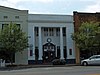 | 1 Temmuz 1988 (#88001008) | 396 Fairhope Ave. 30°31′22″N 87°54′12″W / 30.522778°K 87.903333°B | Fairhope | |
| 4 | Battles Wharf Historic District | 28 Nisan 1988 (#88000107) | U.S. Route 98 (Eastern Shore Boulevard) roughly between Woolworth Ave. and Buerger La. 30°29′37″N 87°55′38″W / 30.493611°K 87.927222°B | Battles Wharf | ||
| 5 | Beckner House |  | 1 Temmuz 1988 (#88001007) | 63 S. Church St. 30°31′15″N 87°54′17″W / 30.520833°K 87.904722°B | Fairhope | |
| 6 | Blakeley |  | 25 Haziran 1974 (#74000397) | Along the Tensaw River north of Spanish Fort[4] 30°44′32″N 87°55′27″W / 30.742222°K 87.924167°B | Spanish Fort | |
| 7 | Carl L. Bloxham Building |  | 30 Haziran 1988 (#88001005) | 327 Fairhope Ave. 30°31′23″N 87°54′15″W / 30.523056°K 87.904167°B | Fairhope | |
| 8 | Bottle Creek Indian Mounds |  | 2 Aralık 1974 (#74000398) | Northern end of Mound Island along the eastern side of the Middle River[5] 31°00′32″N 87°56′24″W / 31.008889°K 87.940000°B | Stockton | |
| 9 | Brodbeck-Zundel Historic District |  | 28 Nisan 1988 (#88000520) | Scenic U.S. Route 98 and Old Marlow Rd. 30°28′27″N 87°55′09″W / 30.474167°K 87.919167°B | Point Clear | |
| 10 | Brunell House |  | 22 Ağustos 1995 (#95001019) | 12113 Jessamine St. 30°24′02″N 87°46′36″W / 30.400556°K 87.776667°B | Magnolia Springs | |
| 11 | Captain Adams House | 20 Aralık 1988 (#88002810) | 907 Captain O'Neal Dr. 30°35′25″N 87°54′51″W / 30.590278°K 87.914167°B | Daphne | ||
| 12 | George W. Cullum House | 14 Haziran 1990 (#90000930) | 1915 Old County Rd. 30°36′19″N 87°54′39″W / 30.605278°K 87.910833°B | Daphne | ||
| 13 | Fairhope Bayfront District |  | 1 Temmuz 1988 (#88001003) | Roughly bounded by Blakeney, N. and S. Summit Sts., Fels Ave., and Mobile Bay 30°31′28″N 87°54′32″W / 30.524444°K 87.908889°B | Fairhope | |
| 14 | Fairhope Downtown Historic District |  | 16 Mart 2006 (#04000115) | Roughly bounded by Equality St., Fairhope Ave., Morphy Ave., School St., and Summit St. 30°31′21″N 87°54′11″W / 30.5225°K 87.903056°B | Fairhope | |
| 15 | First Baptist Church |  | 25 Ağustos 1988 (#88001349) | Northern side of D'Olive St. 30°53′05″N 87°46′36″W / 30.884722°K 87.776667°B | Bay Minette | |
| 16 | Foley Downtown Historic District |  | 19 Ocak 2005 (#04001496) | Parts of Alston, McKenzie, E. and W. Laurel and W. Orange Sts.; also parts of Laurel & Pine Sts., W Myrtle, E & W Rose, W. Orange & W Jessamine Aves. 30°24′24″N 87°41′02″W / 30.406667°K 87.683889°B | Foley | Boundaries originally encompassed parts of Alston, N. and S. McKenzie, U.S. Route 98, E. and W. Laurel, Myrtle, Rose, and W. Orange until a boundary decrease of 4 Haziran 2012; boundaries further increased on 20 Eylül 2019. |
| 17 | Fort Mims Site |  | 14 Eylül 1972 (#72000153) | Southwestern quarter of Section 36, Township 2 North, Range 2 East[6] 31°10′50″N 87°50′17″W / 31.18050°K 87.83797°B | Tensaw | Site of a battle during the Creek War. On August 30, 1813, Red Stick Creeks killed or captured 517 settlers, militia, and their allies at Fort Mims. |
| 18 | Fort Morgan |  | 15 Ekim 1966 (#66000146) | Western terminus of State Route 180 30°13′41″N 88°01′23″W / 30.228056°K 88.023056°B | Gasque | |
| 19 | Gaston Building |  | 1 Temmuz 1988 (#88001004) | 336 Fairhope Ave. 30°31′22″N 87°54′14″W / 30.522778°K 87.903889°B | Fairhope | |
| 20 | Golf, Gun & Country Club |  | 1 Temmuz 1988 (#88001002) | 651 Johnson Ave. 30°31′22″N 87°53′41″W / 30.522778°K 87.894722°B | Fairhope | |
| 21 | Governor's Club |  | 31 Ağustos 2000 (#00001031) | 11866 Magnolia St. 30°23′46″N 87°46′34″W / 30.396111°K 87.776111°B | Magnolia Springs | |
| 22 | Hamner House |  | 20 Aralık 1988 (#88002811) | Oak Rd. off County Road 6 30°19′07″N 87°42′27″W / 30.318611°K 87.7075°B | Bon Secour | |
| 23 | Jenkins Farm and House | 20 Aralık 2016 (#16000862) | 29040 Jenkins Farm Rd. 30°38′51″N 87°48′15″W / 30.647529°K 87.804053°B | Loxley | ||
| 24 | Axil Johnson House |  | 3 Temmuz 1997 (#97000649) | 751 Edwards St. 30°31′39″N 87°53′24″W / 30.5275°K 87.89°B | Fairhope | |
| 25 | Killcreas House |  | 4 Mayıs 1995 (#95000556) | 46833 State Route 225 30°54′26″N 87°51′23″W / 30.907222°K 87.856389°B | Bay Minette | |
| 26 | Latham United Methodist Church |  | 25 Ağustos 1988 (#88001350) | Eastern side of State Route 59 31°05′54″N 87°49′51″W / 31.098333°K 87.830833°B | Latham | |
| 27 | Lebanon Chapel AME Church |  | 25 Ağustos 1988 (#88001351) | Bounded by Young St. on the west and Middle St. on the north 30°30′48″N 87°53′39″W / 30.513333°K 87.894167°B | Fairhope | |
| 28 | Magnolia Springs Historic District |  | 27 Ocak 2012 (#11001046) | Roughly along Oak, Spring, Bay, Jessamine, Magnolia, Pine & Rock Sts., Island, Cedar & Holly Aves. & Magnolia Springs Highway 30°23′59″N 87°46′34″W / 30.399642°K 87.7761°B | Magnolia Springs | |
| 29 | Malbis Plantation |  | 10 Mayıs 2011 (#11000238) | 10145 US 90 30°39′13″N 87°50′32″W / 30.653611°K 87.842222°B | Daphne | |
| 30 | Manly-Strong House |  | 22 Ağustos 2019 (#100004134) | 100 Deer Ct. 30°35′23″N 87°54′51″W / 30.5896°K 87.9143°B | Daphne | |
| 31 | McMillan House |  | 20 Aralık 1988 (#88002812) | 1404 Captain O'Neal Ave. 30°35′52″N 87°54′42″W / 30.597778°K 87.911667°B | Daphne | |
| 32 | Methodist Episcopal Church, South |  | 22 Eylül 1980 (#80000679) | 1608 Old County Rd. 30°36′06″N 87°54′31″W / 30.601667°K 87.908611°B | Daphne | |
| 33 | Montgomery Hill Baptist Church |  | 25 Ağustos 1988 (#88001352) | Eastern side of State Route 59 on County Road 80 31°09′46″N 87°47′12″W / 31.162778°K 87.786667°B | Tensaw | |
| 34 | Montrose Historic District |  | 3 Haziran 1976 (#76000310) | Main (State Route 42) and 2nd Sts. 30°34′07″N 87°54′02″W / 30.568611°K 87.900556°B | Montrose | |
| 35 | Moore Store |  | 30 Kasım 2001 (#00001027) | 14770 Oak St. 30°24′04″N 87°46′15″W / 30.401111°K 87.770833°B | Magnolia Springs | |
| 36 | Nelson House |  | 20 Aralık 1988 (#88002814) | State Route 59, North 31°05′08″N 87°49′52″W / 31.085556°K 87.831111°B | Latham | |
| 37 | Nicholson House |  | 20 Aralık 1988 (#88002813) | County Road 6 30°17′33″N 87°44′13″W / 30.2925°K 87.736944°B | Oyster Bay | |
| 38 | Orrell House |  | 20 Aralık 1988 (#88002815) | County Road 6 30°18′59″N 87°42′14″W / 30.316389°K 87.703889°B | Bon Secour | |
| 39 | People's Supply Company |  | 21 Şubat 1997 (#97000096) | 21950 Broad St. 30°32′41″N 87°45′03″W / 30.544722°K 87.750833°B | Silverhill | |
| 40 | Point Clear Historic District | 28 Nisan 1988 (#88000515) | Western side of U.S. Route 98/Eastern Shore Boulevard 30°28′48″N 87°55′40″W / 30.48°K 87.927778°B | Point Clear | ||
| 41 | St. Mark's Lutheran Church |  | 25 Ağustos 1988 (#88001353) | Western side of County Road 83 30°25′01″N 87°35′55″W / 30.416944°K 87.598611°B | Elberta | |
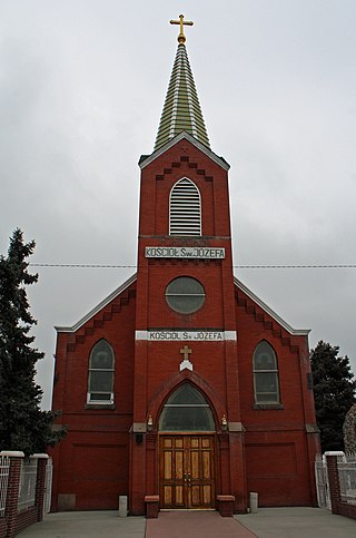
| 42 | St. Patrick's Catholic Church |  | 25 Ağustos 1988 (#88001354) | Eastern side of U.S. Route 90 30°37′11″N 87°45′10″W / 30.619722°K 87.752778°B | Loxley | |
| 43 | St. Paul's Episcopal Church |  | 25 Ağustos 1988 (#88001355) | Northern side of Oak Ave. 30°24′05″N 87°46′17″W / 30.401389°K 87.771389°B | Magnolia Springs | |
| 44 | Sand Island Light |  | 12 Kasım 1975 (#75000305) | Southwest of Fort Morgan off Mobile Point 30°11′15″N 88°03′02″W / 30.1875°K 88.050556°B | Fort Morgan | |
| 45 | School of Organic Education |  | 1 Temmuz 1988 (#88001010) | Bounded by Fairhope and Morphy Aves. and Bancroft and School Sts. 30°31′17″N 87°54′05″W / 30.521389°K 87.901389°B | Fairhope | |
| 46 | Lewis Starke House | 14 Haziran 1990 (#90000929) | 2103 Old County Rd. 30°36′26″N 87°54′39″W / 30.607222°K 87.910833°B | Daphne | ||
| 47 | State Bank Silverhill |  | 31 Aralık 2001 (#01001410) | 15950 Silverhill Ave. 30°32′42″N 87°45′05″W / 30.545°K 87.751389°B | Silverhill | |
| 48 | Stockton Methodist Church |  | 25 Ağustos 1988 (#88001356) | Eastern side of State Route 59 31°00′57″N 87°51′11″W / 31.015833°K 87.853056°B | Stockton | |
| 49 | Street House |  | 20 Aralık 1988 (#88002816) | Wood Acres Rd. off County Road 3 30°27′52″N 87°53′54″W / 30.464444°K 87.898333°B | Point Clear | |
| 50 | Henry Stuart House |  | 27 Ekim 2006 (#05000841) | 22787 U.S. Route 98 30°33′23″N 87°53′38″W / 30.556389°K 87.893889°B | Montrose | |
| 51 | Sunnyside Hotel |  | 20 Şubat 1998 (#98000111) | 14469 Oak St. 30°23′59″N 87°46′36″W / 30.399722°K 87.776667°B | Magnolia Springs | |
| 52 | Svea Land Company Office |  | 7 Mart 1985 (#85000443) | S. 6th St. 30°32′41″N 87°45′14″W / 30.544722°K 87.753889°B | Silverhill | |
| 53 | Swift-Coles House |  | 6 Aralık 2016 (#16000814) | 1 Swift Coles Ln. 30°18′46″N 87°43′35″W / 30.312761°K 87.726491°B | Bon Secour | |
| 54 | Swift Presbyterian Church |  | 25 Ağustos 1988 (#88001357) | Swift Church Rd. 30°22′30″N 87°37′41″W / 30.375°K 87.628056°B | Miflin | |
| 55 | The Texas |  | 20 Aralık 1988 (#88002817) | 306 Dryer Ave. 30°36′02″N 87°54′37″W / 30.600556°K 87.910278°B | Daphne | |
| 56 | Twin Beach AME Church | 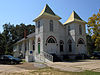 | 25 Ağustos 1988 (#88001358) | Southern side of County Road 44 30°30′04″N 87°54′34″W / 30.501111°K 87.909444°B | Fairhope | |
| 57 | U.S.S. TECUMSEH |  | 14 Mayıs 1975 (#75000306) | Northwest of Fort Morgan in Mobile Bay 30°13′54″N 88°01′33″W / 30.231667°K 88.025833°B | Fort Morgan | |
| 58 | US Post Office |  | 1 Temmuz 1988 (#88001001) | 325 Fairhope Ave. 30°31′23″N 87°54′15″W / 30.523056°K 87.904167°B | Fairhope | |
| 59 | Walker House | 20 Aralık 1988 (#88002818) | 905 Captain O'Neal Dr. 30°35′23″N 87°54′51″W / 30.589722°K 87.914167°B | Daphne | ||
| 60 | White Avenue Historic District | 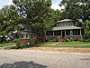 | 1 Temmuz 1988 (#88001009) | White Ave. 30°31′10″N 87°54′04″W / 30.519444°K 87.901111°B | Fairhope | |
| 61 | Whittier Hall |  | 7 Mart 1985 (#85000442) | 201 Magnolia Ave. 30°31′29″N 87°53′45″W / 30.524722°K 87.895833°B | Fairhope | |
| 62 | Zurhorst House | 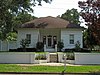 | 1 Temmuz 1988 (#88001006) | 200 Fels Ave. 30°31′16″N 87°54′23″W / 30.521111°K 87.906389°B | Fairhope |
Ayrıca bakınız
- Alabama'daki Ulusal Tarihi Yerler Listesi
- Alabama'daki Tarihi Yerler listeleri Ulusal Kayıt Listesi
Kaynakça
- ^ "National Register of Historic Places: Weekly List Actions". National Park Service, United States Department of the Interior. Retrieved on February 5, 2021.
- ^ Sayılar, anlamlı sözcüklerle alfabetik bir sıralamayı temsil eder. Tanımlanmış çeşitli renkler National Historic Landmark ve tarihi bölgeler ve diğer NRHP binalar, yapılar, alanlar veya nesneler için farklıdır.
- ^ Her tarihin altındaki sekiz basamaklı sayı, National Register Information System veritabanındaki her bir konuma atanan sayıdır ve bu sayıya tıklanarak görülebilir.
- ^ Location derived from its GNIS feature record; the NRIS lists the site as "Address Restricted"
- ^ Location derived from its placement on USGS topographical maps[]; the NRIS lists the site as "Address Restricted"
- ^ Riccio, Joseph F., and Conrad A. Gazzier. "Infrared Color Photography of the Fort Mims Site, Alabama". Journal of Alabama Archaeology 20.2 (1974): 216-221: 216.